Total distance so far: 1090 km.
 Leaving Adelaide on 9th May took me down through Murray Bridge and the little town of Wellington, where I crossed the Murray and headed for Meningie and the Coorong. The Coorong was a particularly long stretch of about 200 km or so, gently up and down all the way.
After a couple of days I arrived in Kingston, from where I went to Robe and Beachport, all small towns on the coast. From Beachport I headed inland, via Millicent to Mt Gambier.
In Mt Gambier dark clouds started to roll in at night, accompanied by thunder and lightning, and I spent a few days watching the weather to see what would happen next. Eventually it was a case of just leaving and hoping for the best, so off I went to the town of Heywood over the Victorian border.
 That was the most dramatic part of the cycle up until then.
 The day started okay, but behind me there soon appeared menacing dark clouds with the boom of thunder. I had 90 km to ride to Heywood, and the last 40 or so were done in haste with those clouds on my tail. To make things worse, my right knee got really sore so that I could barely push down on the pedal with that leg. I just managed to get in to Heywood with five minutes to spare, on one leg, before the rain came down. Portland (30 km to the south) was covered by black clouds, and it turns out that they got about 45 mm that day. Similar rains appeared to the north, so I was lucky to just squeeze through.
From Heywood (after a couple of days waiting for the rain to clear) I hitched a ride on a fast tail wind that took me east 80 km to Woolsthorpe,
 and then 25 km south to Warrnambool. Again the knee started complaining, and the last 25 km was pretty hard because the tail wind was by then a gusting cross wind--the worst sort. Once in Warrnambool, I spent more days waiting for the rain to clear. While there I bought some bicycle leg warmers and knee wraps, and the sore-knee problem never returned.
After Warrnambool I headed down the Great Ocean Road, again blown by a tail wind across the plains to the coast. Stopped in at Loch Ard Gorge, the site of the Loch Ard ship wreck from 1878 with its tale of the two survivors who came up onto the beach. I happened to chat to a couple there, who turned out to work with a couple of my old school friends in the town where I grew up in Auckland.
Next day saw me cycling 80 km from the tiny settlement of Princetown to Apollo Bay, via Lavers Hill. These were the hardest hills of the trip, with long slow 5 km/h plods going up, followed by quick races down. I only saw two people at the top in the Lavers Hill community: the first was the woman running the local coffee shop, who grunted and twitched negatively when I ordered some kind of "soyaretto mochalattechinorotto" from their menu. I took that to mean it wasn't actually on the menu after all.
 Outside I made polite conversation with a policeman, who grumbled and complained about the government and growled that cyclists shouldn't be allowed in these parts, since he gets to peel their remains off the road regularly. I didn't mind getting away from the Lavers Hill cafe. It also was good to complete that part of the trip; I reckon that the road engineer who planned it had a thing for roller coasters, since the road just went up and down more than roads usually do.
This part of the ride was the absolute southerly part of the trip, so it was neat to finally head north and into Apollo Bay.
 From Apollo Bay I headed up the coast over a couple of days, via Lorne and Torquay, through Geelong to Melbourne. Had very heavy head winds on the highway from Geelong to Melbourne. Eventually there was a sign directing all cyclists to leave the highway, so I peddled through a town and found myself in a one-way road feeding back onto the highway, with a sign that said cyclists were not allowed further. Not sure what to do, so I asked directions from a helpful pedestrian, and found myself on a bike path that seemed to go forever toward Melbourne city, amid very strong head winds. After 20 or so kilometres I abandoned it for the road, got more directions, and finally found my way in to the Melbourne suburb where I was to stay.
In Melbourne, while cleaning my bike, the rear gear cable snapped. This was a pity, since it hasn't snapped in the whole life of the bike, 26 years. I had gotten a new derailleur for the trip, necessary because of getting an easier first gear, and modern derailleurs make more demands on the cabling. And maybe the new derailleur had just been done up too tight, since that's where it snapped. Unfortunately, that cable is no longer made, so I had to have more antiquated gear levers fitted, which take the modern cables (yes, you read that right). The upshot is that I now have a gear system that I can fix if the cable snaps again, but it's more antiquated than what I started with, and isn't as smooth to use. That's progress for you!
Luckily it happened in Melbourne, so I was able to take the bike to a shop in Richmond that specialises in older bikes, and they knew what to do.
Early June: Melbourne to Cann River
Total distance so far: 1680 km.
I left Melbourne with a good tail wind and quickly got south of Frankston, where I turned east. Passed through the small town of Tooradin just as the rain came in--the only real bit of cycling through rain I've had. Next day I headed south-east through small towns like Leongatha. I left the road at one point to cycle 35 km on the "Rail Trail", a track where a railway used to be. This was good because it avoided the hills and traffic of the main road. The roads in that area have many bends and often no shoulder, which doesn't go well with the traffic using them. Trucks aren't much of a problem since they move over, but cars think they don't need to, so are a worse hassle as they zoom past a metre from me. Having said that, shoulders are not always the great thing they're supposed to be. If there is a shoulder, then I'm expected to use it, regardless of how lousy it is for a bike to be on. And I've struck some roughly made ones...
My most southerly point of this region was near Foster, and from there I followed the road to Yarram and Sale (pictured).
 I ate something disagreeing with my stomach in Yarram, so the next day just pedalled slowly and carefully the 70 km to Sale, not feeling well at all. The road was mostly flat; except when it climbed, that is. So I was happy to get to Sale. The weather got quite sunny there, so I took a couple of days off and went shopping for full-finger gloves, rubber shoe covers, and a bigger tent, sending my small one home.
I left Sale by pleasant back roads with no traffic, going through Bairnsdale to Lakes Entrance, and onto Orbost (caravan park site pictured).
 Out of Orbost the road climbed up and down, up and down, but mostly up it seemed, with drizzle and cold temperatures. At one point when I was pretty high up, a sign announced I was at a saddle. "Great", I thought, "now it goes down again." It did for a few metres of height--but then it climbed even higher. Must write to the Roads Department and tell them what a saddle is.
Finally I zoomed down the last hill and onto a bit of a plain, coming into the small community of Cann River. The weather packed in again so I stayed another day in a very desolate caravan park, waiting for things to clear. But at least the road from here went north (at last!), so it was great to finally head up to Canberra and New South Wales a couple of days later.
Mid June: Cann River to Canberra
Total distance so far: 1980 km.
I headed north from Cann River, slowly climbing through forest country. Just short of the border to NSW the sun came out for the first time in a few days (see the picture), and it seemed like the border was put there deliberately to leave Victoria's cold and grey weather behind.

There were some tough climbs onto the NSW plateau. After about 70 km, having sat myself down on a rock for a much-needed rest and a contemplation of how many more hills there'd be, I jumped back on the bike and realised I was on the plateau and they were all finished. So I headed into the small town of Bombala and pitched the tent at the caravan park, where I was the sole resident besides a friendly goose who ate some of my crackers and biscuits.
Next morning after breakfast (pictured),
 I scraped the ice off the tent and headed north. Twelve km out of Bombala, as I zoomed down a hill, there was a loud bang! zz-ZZ-zz-ZZ-zz-ZZ as a rear spoke had snapped, and because I have a mudguard with minimal gap at one point to the wheel, the now-warped wheel started scraping on it so badly that the bike was very hard to even push, once I'd stopped. Luckily there was a small community a couple of hundred yards away, so I slowly wheeled it there and waved to some people, asking if I could use their yard to fix it. They were great, having me to lunch with the neighbours, with tea and cake. I realised I hadn't brought along the tool to hold the rear gear cluster while it's removed (it's heavy)--horrors! Luckily, the guy had something similar that did the job. I've only ever changed a spoke once, years ago, so this was a case of learning on the job. After lots of messing about trying to "true" the wheel (tighten the spokes evenly to get it planar), I figured the best thing was to spin it and hold a felt-tip pen just shy of it to touch the high spots. With those marked, knowing which spokes to loosen and tighten became easy. The guy later gave me his card: Bombala Cycles and Chainsaws. What a stroke of luck that was.
(Later, I bought a cluster-holding tool and a felt-tip.)
From there I headed up innumerable hills and into the town of Nimmitabel to stay the night. This is around 1100 metres up and very cold. Next day I put on some warm gear and zoomed down (pictured) into Cooma (700 m).
 I had intended to cycle around the mountains in a Cooma-to-Cooma loop, but the freezing time of year and bigger-than-usual snowfalls around Thredbo decided against that. Instead, I headed up the highway, stopping for the day in the tiny town of Bredbo. Had a good dinner there in the one cafe that was open. A friendly hostess, and when I ordered the $2.50 garlic bread as an opener, I got about half a loaf. Then the main, a vegetarian burger so big that it teetered, was accompanied by a huge amount of salad and chips. I don't know where I found room for it all, but I did. That's cycling for you. And the country hospitality was great.
Next day I again climbed many more hills to get to Canberra. Actually, Canberra is lower than Cooma,
 but remember that climbing these hills takes maybe four times as long as descending them, so it really does feel like there are more uphills than down. There I stayed a few days. The pictures were taken at the Australian War Memorial,
 and show a Gallipoli landing boat (note the bullet holes), along with Simpson and his donkey. Why wasn't he ever awarded the Victoria Cross?
Late June to early July: Canberra to Brisbane
Total distance so far: 3300 km.
I headed out of Canberra, calling in to see the miniature village of Cockington Green with its neat models of English village life and places around the world (pictured).
 Passed through Yass and Young, where I waited a day while it rained. Some hilly country here, but I took the back road to Young so missed much of the traffic. From Young I cycled through Grenfell and onto Forbes. The last 20 or 30 km to Forbes were very flat and cruisy; the first really flat parts of the trip (pictured).
 More rain in Forbes, so I visited the town centre for a day and the local cemetery, with its graves of several historic people such as Ned Kelly's sister and Captain Cook's grand niece.
A short trip from Forbes to Parkes, and 25 km further north is the Parkes Radio Telescope, where I spent a couple of hours in the Visitor Centre. The Dish is certainly very impressive. The people behind the desk were also impressed by the look of my bike, so I guess we were all happy.

Onward to the cold tiny town of Peak Hill and the bigger town of Dubbo. In Dubbo there was a warm sun and it felt like the weather was set to improve. Next day through cold cloudy weather and light rain to the small town of Gilgandra, where the rain came in properly yet again for another day while I waited it out.
Then north over some hills (with a huge tail wind though) to Coonabarabran, which is getting high up in altitude and was cold, and where it rained for another day. Got my first puncture here. I only noticed how strong the tail wind was when I stopped to fix the tyre, and found it was blowing a real gale. Pushed north to Narrabri, and from there over flat desolate roads to Moree. More light rain just out of Narrabri, and another puncture. Luckily I got it right next to a small eatery in the middle of nowhere, so I had some cover to fix it. A good thing it was too, since while I was busy, a patch of heavy rain passed over, which meant I was lucky to be under about the only cover around during that short rain spell. Afterwards the sun came out and the day fined up, looking nothing like the cold grey morning had been.
From Moree I went further directly north to Boggabilla and the NSW--Queensland border. A new (rear) tyre installed in Adelaide blew out just before Boggabilla. I wheeled the bike into the adjoining field, and changed it in an area full of thorns while trucks and cars screamed past a hundred metres away. That wasn't much fun--you don't realise how much road noise there is on these desolate roads until you stop. It was still cold here; I had to give up lighting my stove for a hot breakfast in the Boggabilla caravan park because I couldn't operate my flick lighter on account of a very cold thumb. Flicking a lighter's friction wheel in slow motion just does nothing to make a spark. (I've since bought a more ergonomic lighter...)
Next day, over the border to the town of Goondiwindi where I bought two new spare tyres. And now after 1200 or so kilometres cycling north from Cann River west of the Great Dividing Range, it was time to head east to Brisbane for the last 400 km. I went along back roads
 (pictured) through the community of Yelarbon to the town of Inglewood, and from there over hills to the big town of Warwick. More hills over a back road to Cunningham's Gap (pictured),
 which I supposed was my entry to the flat east coast, and which people warned me would be a tough climb. As it turned out, going from west to east, it proved to be a nonevent since I was already high up. A nice cruise down the east side though! Another puncture here. Next day I rode a strong tail wind through Boonah and Beaudesert to the far southern Brisbane suburb of Beenleigh. Chatted with some very friendly people in a health food cafe in Beaudesert. The trip from there to Beenleigh (where I'm staying) was a continual up and down--nothing steep or high, but just one small hill after another, many requiring a slow climb in first gear.
But the weather is getting a lot warmer now, as much as ten Celsius degrees warmer than it was in towns like Coonabarabran a week ago, and the skies are blue. The city is on tight water restrictions and the water cops are out checking people's water meters to make sure they really are only taking their 4-minute showers. And I'm even feeling a spot of sunburn for a change!
Late July: Brisbane to Cairns
Total distance so far: 5200 km.
It's easy to think that Brisbane is somewhere far up the east coast, but there is still almost 2000 km to go north to reach Cairns, where I was headed next.
First, Brisbane had to be crossed and exited, and that was just arduous. I was on the south side, and options for getting north on a bike are limited, short of going around the whole city, which I wasn't going to do. The whole cross-city route involved about 90 km of traffic lights, and I needed to cross a particular bike-friendly bridge near the city centre. This bridge turned out to be out of bounds due to road works, but luckily another cyclist appeared who showed me the way across a different bridge. When I'd crossed the city, a motorway started that I wasn't allowed on. So began a couple of days of arduous detours.
I managed to go fairly directly north, cycling on a back road past Australia Zoo called, as you might expect, Steve Irwin Way. So much for taking back roads: what a dangerous road that one is! No shoulder and heavy traffic of trucks and cars. Some helpful ladies in Landsborough suggested a detour to the Sunshine Coast, so off I went east to Caloundra and headed north of that. The several kilometres I cycled along this coast went through some new town development, and how soulless that all was. It all looked identical to the "development" that is happening to so many cities these days. Eventually I was stopped by another motorway, got more directions, and headed back west, eventually to be pretty much lost in back roads. I found my way to the pretty Forest Glen Caravan Park. I noticed around here that tropical vegetation was beginning to appear.
Heading north of Forest Glen took me back on a motorway. There is certainly a huge amount of traffic constantly streaming out of Brisbane. The locals weren't clear about whether I was allowed on this motorway or not, but I figured it had to be better than a road like Steve Irwin Way, so off I went on it, but eventually exited to find a back road to Gympie, the next major stop. Gympie itself seems to be a cold spot, and the night I was there, the temperature got down to a little below freezing.
I had picked up a cold and needed to stop for a few days to lose it, but a cold tent wasn't the place for that, so off I went to Maryborough to spend a few relaxed days in the sun wandering about. It was in Maryborough that the countryside vegetation really started to take on a tropical look. The town is particularly proud of its most famous daughter, the author Pamela Travers.
 Next to the building in which she was born a century ago is a statue of the nanny she made famous: Mary Poppins.
From Maryborough I headed north along roads that had gradually become mostly flat, to Rockhampton, through which the Tropic of Capricorn runs (pictured).
 In the southern hemisphere the sun is mostly found in the northern part of the sky, but as you travel north, it begins to climb higher. Here at the Tropic, at noon on the longest day of the year, the sun just reaches the zenith; any farther north, and it spends some of the year in the southern part of the sky. I spent a day here getting a haircut and wandering about, and then I continued on up the coast, finally stopping the wearing of my leg warmers and knee wraps. I had worn them for the last 3000 km since Warrnambool, and while it had felt strange to cycle with black stockings when I had first put them on, now it felt strange to cycle with bare legs.
Heading up the coast, I noticed the night sky slowly beginning to change. This is a feeling that we don't really get anymore in this age of walking into a plane, flying around the world, and walking off in a place where the constellations are different. As I cycled, the South Celestial Pole around which everything turns was dropping slowly in the sky, and northern constellations (invisible from Adelaide) were beginning to appear low down on the northern horizon. Orion the hunter, who normally rises poised somewhat on his shoulder, now rises in the early morning much more tilted onto his side. This feeling of really moving over Earth's curved surface must be a familiar one to seafarers.
I cycled through many roads like the two pictured below. There are many, many miles up the coast, and yes, it did mostly all look like these pictures; that is, when there weren't lots of cars and trucks speeding by, as there usually were. I have run into tourist season up here, and it's also sugar cane harvest time, so there are plenty of trucks over the roads.


Heading farther north took me through Townsville and finally to Cairns. The route here is more varied and picturesque than much of the previous thousand-odd kilometres. Climbing a steep hill gave a photo opportunity (pictured). At occasional points along these roads, signs like the one pictured began to appear.


Finally, I arrived in Cairns and have spent a few days here. Highlight of my short stay has been a visit to the Great Barrier Reef. This was a day-long boat trip with about fifty people, about two hours' travel each way to a couple of reef spots where snorkelling was allowed. Snorkelling around a shallow beach can be fun, but the ocean was quite rough where we stopped for a couple of hours, and after bobbing up and down in the water for a few minutes, I decided it wasn't for me. But I was told that scuba diving is easier, so I decided with a handful of others to try that instead. And how much easier it was, and a whole lot of fun! Having no experience, everything was done for us; first we had to practise a couple of things like removing the mouthpiece for a few seconds under water (surprisingly difficult: it certainly
 went against my self-preservation instinct, and the instructor joked about having to prise these things out of people's mouths afterwards). After that, we descended to enter a different world of Jacques Cousteau documentaries, and what a beautiful world it was.
 I spent an hour in total on two dives, swimming about colourful corals past all manner of fish; fed seaweed to the friendly resident turtles, and generally saw things that the snorkellers high above could only perceive dimly below. Worrying about how my equipment was doing was the instructor's job, so it was all quite easy and fun.
But then, then! We still had to return to Cairns, a two-hour trip through a sea that had picked up in choppiness. Normally I might feel just a bit uneasy on a boat, but this turned out to be a trip that few of the passengers will ever forget. Shortly in, the wind picked up and the boat started rocking and pitching so violently that it was easy to think it was about to roll right over. One of the crew remarked afterwards that he'd never been on a boat where at least half the passengers had been sick. The captain pushed on through very choppy seas, while water crashed in through gaps in the windows, and occasionally things would slide about, diving tanks would crash into each other, and everyone would gasp while it felt like we were in short periods of free fall. Paper bags came out in bulk, but to me they looked awfully small. I just tried to keep my eyes on one point on the horizon in order to hold my head as fixed as possible relative to the outside world.
Not wanting to use one of those bags, I eventually decided to get outside in smart fashion. While the boat rolled, I lurched out past people in zombie-like states (holding bags to their faces like oxygen masks), as I tried not to zig-zag (it doesn't look seemly). On deck after a close study of the ocean (to put it politely), I watched while waves of seawater washed over everything, including my shoes, but, well, at least I was able to stand, and there is always someone who has it worse. In this case he sat on the deck floor, wedged as best he could between two closely spaced walls, water spraying him and swilling all around him, and occasionally he put his head a little to one side to throw up. Meanwhile, a few passengers were completely unaffected. One guy read a book, others chatted and drank beer. They'd probably made a pact with the Devil, but no doubt he'll return to claim his own.
After a few minutes I went back inside, and while the ship lurched into another huge wave, I managed to collide successfully with a table to which I clung like a magnet for five or ten minutes. But soon it seemed that the deck would again be a better option, so this time I headed for the other deck (variety doesn't hurt). As I stood there thinking that the outside air was better than sitting inside, a huge wall of spray dumped right through me, and then the shivering started. What to do? I headed back inside, delicately plucked a bag from a bunch that someone offered me (mumbling something like "Mind if I take one?"), and sat down on a hard metal staircase. Closed my eyes, rested head on arm and arm on bannister, and concentrated on surviving while the ship threatened to become airborne.
Meanwhile, the crew were cheerful, and I heard one of them say that we'd be back in port in... how many minutes did he say? Four? "How long?" I asked him. "We'll be there in forty minutes" he replied. So, what else was there to do but settle down to the misery of it all and sympathise with all the millions of people over the course of history who have had to live (and die) through similar things. After half an hour the sea eased up, and like a spring thaw, everyone including me started to come back to life. And luckily, the seasickness mostly vanished once I was on dry land, although the bus trip I took into the city this morning with a crazy driver brought some of that feeling back again (three hours later, it's still with me as I write this). I just hope that eventually the memory of the scuba dive outweighs that of the return trip!
From here I'll head up the coast for another day or so, and then it's west to Normanton and Darwin.
August to early September: Cairns to Darwin
Total distance so far: 8400 km.
To go inland from Cairns, I headed 75 km north to Mossman, where I had lunch in a park and then did a fairly meaningful u-turn (to me, anyway) to head a short distance south to the turn-off west.
 This took me on a long climb onto the inland plateau, almost a kilometre above sea level. This area is called the Atherton Tableland, but is anything but a tableland. More like an egg-crate surface really, with many many small hills (always noticeable to a cyclist). Being so high up, the weather here was cold and a little rainy (pictured).
I cycled south for about 150 km through towns like Mareeba, Atherton, Malanda, and the strange-sounding Millaa Millaa, and then turned west at Ravenshoe to really begin to go inland at last. From here the road became harsher; red earth was all around, and the very occasional roadside stop was never particularly sheltered.
 The busy traffic on the east coast fell away to almost nothing now.
West of the town of Mt Garnet and heading to Georgetown, things became very dry, and the road shrank down to one lane for the most part--although it had a wide shoulder of gravel, as pictured. It was like this for a couple of hundred kilometres, sometimes becoming two lanes, then shrinking back to one.

This was road-train territory, since this route is heavily used by mining trucks usually pulling four trailers. (West of Mt Isa I took the accompanying photo of a road train bringing vegetables from Kununurra, a couple of thousand kilometres away. This has just three trailers, but gives an impression of how big these things are.)
 These trucks have right of way on the narrow roads, and for good reason. The driver of the one pictured told me that he doesn't have much control over the last trailer, and sure enough, I did later come across a sad accident (on a two-lane road west of Mt Isa) where a road train carrying cows had flipped over. Police and a crane were in attendance, and there were several piles of dead cows on the side of the road.
So that lack of control means that other traffic needs to leave the bitumen on these single lane roads when a road train comes past. For me it wasn't a problem, since I could easily put the bike on the gravel shoulder. It was more a problem for cars towing caravans, especially because the shoulder was usually raised a couple of metres above the surrounding land. I would keep an eye on my rear-view mirror and up ahead for these trucks, and would stop on the shoulder and wait for it to pass when one showed up.
Early on I had a particularly electric moment when I hadn't yet formed the habit of actually stopping while these trucks passed. A four-trailer truck showed up behind me, and I dutifully moved onto the shoulder, but I kept cycling. There was plenty of room, but as the truck approached, I decided to move a little further to the left to give myself even more room. Bad move: I hit a long ridge of sand parallel to the road, and as the truck thundered past, I lost steering. There was nothing for it but to get the bike off the shoulder pronto--I don't know whether I or the bike decided that, but together we hurtled down the gravel bank. The front wheel quickly flicked to the left and right as I tried without success to regain control of the steering. As we skidded down the gravel, at the last moment, the front wheel flicked to the right, the tyre bit in to the gravel, and the bike regained its balance, sending us both zooming back up the gravel slope and onto the road shoulder once more. The whole thing had only taken a few seconds, but after that I always stopped when moving over for a truck.
This was particularly dry, hot country. I jumped between the towns of Georgetown, Croydon, and Normanton in three leaps of 150 km each, and it was the first time in the trip where there was nothing in between each town, save lots of vegetation and roads leading off to distant farms ("distant" means easily 100 km away up a dirt track). In Croydon I needed to get a small bit of welding done on my rear carrier. A weld had broken there, perhaps because I'd stressed it by putting a plastic tie onto it in order to hold something else. Luckily the small town had someone who was willing to try (aluminium is difficult to weld). I asked him to try to do it without removing the carrier, since that's a messy job in itself. He was probably more used to welding road trains I guess, since he explained in colourful language that he was worried he'd make a big hole in the bike by welding something so small. Even so, he seemed happy with his handiwork when it was finished, and it has lasted so far.
Normanton is a sort of crocodile capital--the largest crocodile ever "captured" (whatever that means) in the world was taken here a half century back. A life-sized replica of it now stands in Normanton.
 See my bicycle for a size comparison.
I had hoped to be able to go directly west of Normanton, but the road wasn't sealed, so instead I detoured south to Cloncurry before heading west again. There was a 130-km stretch of intense head winds just before Cloncurry, part of a low pressure system that was causing immense flooding on the east coast at that time. Head winds can be very difficult, and that 130 km took me ten hours over two days to battle through. With a tail wind this would only take five hours. That doesn't mean a tail wind makes things (only) twice as easy though! It comes down to five hours of brisk quiet cruising versus ten hours of battling, with the wind shrieking in one's ears.
I then headed west of Cloncurry through the mining town of Mt Isa, then in one day jumped the 190 km to the small town of Camooweal.
 On the way I passed a good roadside stop with a stretch of the original road preserved, built during the Second World War. You can compare it to the modern road that passes it; the old road goes up and down over the terrain, and would certainly have been tough to cycle on. I was quite taken by the fact that at one point, a police car pulled up alongside and they called out asking if I was okay and did I have enough water. I called back that I was fine and that I had ten litres, which should be enough thanks. So that was good.
Camooweal lies just before the Northern Territory border and before I left it, there was time for a quick photo shoot.


And so, onward to the Northern Territory. The border is pictured here. (Actually the sign writing is readable on my original photo, but it's harder to read on the smaller version you get by clicking on the photo here.)

This area is known as the Barkly Tableland, and unlike the Atherton Tableland, the Barkly really is flat, and also devoid of trees for the most part. It also had a strong crosswind. A couple of days of this and I made it to the Barkly Homestead (pictured),
 which offers the usual in road houses: accommodation, food, drink and petrol. From the Barkly I headed west once more, through more heat and long roads, and past several small bush fires. Much of the road verge had been recently burnt, but it turned out to be a controlled scrub burn-off. At one stage I passed the blackened hulk of an old car that had perhaps been stolen and parked in the bush, who knows, decades ago? and now lay uncovered by the burnoffs.
A day out of Barkly and I made another 190-km leap to Three Ways Junction, a major intersection where the westbound road finally meets the road coming up from Adelaide. I'd had a particular mental image of this junction, but the reality was much more subdued (pictured).

Now it was time to head north, eventually onto Darwin, the most northerly point of my trip. (Well, it would have to be the most northerly point of most people's trips in Australia). There were a couple of days where the prevalent cross wind/tail wind for some reason produced a strong wallop every time something big passed from the opposite direction. The worst I had it was when two road trains were set to pass each other just where I was. I got the bike well off the road, stopped and braced myself, and sure enough there was a huge ka-whump as they went past, although I managed to remain standing. Days later the road trains didn't affect me as much, so I presume it was all related to the wind's direction.
I passed through several road houses like Renner Springs and Dunmarra here. One of the few towns along several hundred kilometres of very uniform road was Elliott, where I stopped to stock up on groceries. Things are very expensive in Elliott. The town is set around four petrol stations, and each has a small grocery attached. A small bottle of honey that would probably cost $2 in Adelaide cost me $9 here. It was marked as such, but I did wonder whether the locals also had to pay this. If so, life must be hard in Elliott. There would be little work, and a government handout doesn't get you much with prices like that.
Further north I spent a night at the camp ground in Daly Waters. Bill Bryson mentions the historic pub
 here (pictured) in his book "Down Under", and it is certainly something to see, with its walls covered with ID cards and licences donated by happy customers. I don't think I'd like to donate my driver's licence to a pub wall, but plenty of people from around the world are happy to. Not far from the pub is the "Stuart Tree" (pictured)
 , where the explorer John Stuart supposedly carved his initial S when he passed by in 1862. There is an indentation in the wood that could well have had his initial, but it's not clear now whether he did or didn't. It's still a famous tree though.
The next day I stopped at the roadhouse/campground in the settlement of Larrimah, and drank a record 3 litres of coffee/chocolate-flavoured milk. I was pretty full after this, so decided to stay the rest of the day and night at the campground. After finishing the milk I put the tent up--and then sat down and drank another 1.25 litres of lemon-lime soft drink. Where the body put it all, I have no idea.
Heading out from Larrimah, I covered the 183 km to the large town of Katherine in a day. From here I would head north to Darwin and then return to Katherine, in order to head west. I decided to take the long way to Darwin, by way of the Kakadu National Park. So I cycled through the tiny town of Pine Creek and then on to the small town of Jabiru, which services Kakadu and the local uranium mines. The 150-km cycle from a road house to Jabiru sounded not too difficult, but in fact I did it on a burning 36-degree day with head winds, zillions of flies that inhabit the Kakadu area, and lots of smallish hills to be climbed. I wasn't stopping enough to drink (thanks to being besieged by flies every time I did stop, although I do use a face net), and as the day wore on I found myself getting very tired.
The 100-km mark came and went and I had stopped twice to drink a lot of water, but still not enough. I found myself getting more and more restless on the bike. Sitting down didn't feel right, standing on the pedals didn't feel right, I just couldn't seem to find a good gear, and flies kept finding me and buzzing around my head and ears. They seem to like landing on and crawling around my glasses, for some reason. (The glasses are mirror coated, so maybe the flies like seeing themselves.) Fact was, I was dehydrated even though I still had a fair amount of water on the bike, but I kept pushing on, not wanting to stop. Instead I watched the kilometres tick by, pedal by pedal. 105.00, 105.01, 105.02... 112.25... 119.34... By the time I passed 140 km, I was thinking that it might be a good idea to just stop where I was and camp, which didn't look inviting since the environment looks particularly harsh to drag a bike into. Plus I hadn't planned on this and didn't have enough water, although that wouldn't be a problem, since I could always hail a passing caravan and ask for some. Still I pushed on. Then, out of the blue (I couldn't remember having seen any sign), there suddenly appeared the Kakadu Visitor Centre. Ten minutes later I had downed a couple of litres of various sweet drinks (I could've had more, but they were closing, and anyway I can't manage the bike well with more inside), two big chocolate muffins, and a couple of free biscuits that the woman behind the counter threw in since I guess I looked like I needed the sugar. Well you know, unlike car drivers, I might not have seen any of Kakadu's famous sights (they're all 30 km down unsealed roads), but there was something here that I did do, which few people in this area get to do. That is, I found out what an oasis is, and that's something that has to be experienced, as opposed to just driven to.
I looked around the Visitor Centre until they closed, and then cycled the last few kilometres to Jabiru, where I drank another two litres of sweet drinks.
Next day I headed west from Jabiru to Darwin, but I couldn't resist the photo of the crocodile sign en route. There's no danger of course; crocodiles aren't where the sign is!
 I'm supposed to be looking nervous for the camera, but it was hard to do that with the sun in my eyes.
Speaking of crocodiles, I found the sign in the next picture to be a little bit odd.
 It's an advert for a rentable houseboat in this region of crocodile-infested rivers. I'm not sure that using a picture of a happy well-fed crocodile is quite the thing to advertise a houseboat.
About 100 km before Darwin, I stayed at the Corroboree Park Inn, a road house that had its own big salt water crocodile named Brutus (pictured).
 Salties are the very dangerous type. Here you can see Brutus coming half out of his pond as one of his feeders turned up. We were told that Brutus had become something of an international star some time back, when a tree above his pond needed trimming. Brutus was fenced off and the tree trimmer got to work. But the sound of the chainsaw upset Brutus, who let everyone know. As a result, the guy trimming the tree threw down the chainsaw--which stopped immediately, as they are meant to do--and leapt out of the enclosure. Brutus grabbed the chainsaw and waved it around, and the upshot was that his photo went out around the world with headlines to the effect of "Chainsaw-wielding croc attacks man".
And so it was on to Darwin, which apparently used to be a small cosy city with its own building height restrictions, but now those restrictions are ignored because they don't suit developers. That's Darwin--another city that wants to be a big city. Still, it was nice to go to the movies here a couple of times before cycling back down to Katherine in order to head towards Western Australia.
Late September: Darwin to Broome
Total distance so far: 10,600 km.
Now it was time to head south from Darwin through the tiny community of Adelaide River,
 the small town of Pine Creek, and finally the much bigger Katherine, to begin the long trek to the west coast. Here is where it really started to get tough and remote. I was intrigued by the car that seemed to have plunged off the raised road at who knows when in the past. It had presumably been burnt out when fire had gone through the area, which seems to have happened to a great deal of the roadside scrub that I've cycled past.
After hearing something on the radio about the Northern Territory community of Nhulunbuy, I looked it up on the map (difficult when you only hear its name spoken), and was surprised to find such an incredibly remote community. It lies on the north-eastern corner of the Territory, at the end of a 700-km unsealed road that emerges somewhat south of the already-small Katherine. Most traffic into the town is by air, and it's actually a mining town, which means housing there is (apparently) very expensive, which is bad for the locals.
Just out of Katherine is Katherine Gorge, and an unexpected river in this harsh, dry region.
 On the way out to the gorge I passed a property with a small crater on it, together with what I suppose is an example of the type of bomb that had produced it back in 1942, when this part of Australia came under some heavy bombardment by the Japanese. I'm told that the first bombing of Darwin used more explosives than Pearl Harbor.

The bus stop pictured was intriguing in that I presume it is a real bus stop. I guess they don't worry too much about rain up here while waiting for the bus.

Heading south west of Katherine, and the really remote part of the country began to open up. Over the next couple of days, I stopped off at the road houses (petrol stops and accommodation) of Victoria River and Timber Creek. From here there was a long slight climb towards the state border with Western Australia. This is baobab country, where the big trees of that name are to be found (they are called boabs in Australia).
 See my bike for a size comparison in the picture. (The bike is set back somewhat, but not all that far.) I have long wanted to see boabs after seeing them drawn in Saint Exupery's classic book, "The Little Prince", and I was not to be disappointed, since they are plentiful here.
Crossing the border, and it's only a short cycle to the small town of Kununurra, which is just as old as I am. I was pleased to arrive here because Kununurra was the first town since Katherine, about 500 km back. The town lies just north of a huge artificial lake, Lake Argyle, which was carved out in order to create a vegetable-growing industry in the area, and this is why Kununurra is here, sending out road trains full of vegetables, such as the one I met some weeks ago around Mt Isa. There is no shortage of fresh water in the town--the lake is huge--but Kununurra has just been put on very tight water restrictions, owing to the state government's "one size fits all" approach to conserving water throughout Western Australia. It seems that every resident sees this as complete nonsense; for example, public gardens in the town will most likely die through lack of watering, and what will that do for tourism in the area?
Getting accommodation when you live in some of these small towns is very difficult. I heard a radio programme a couple of months ago on this subject, but I don't recall whether they were talking about Kununurra or Karratha, another Western Australian town. With mining in the area of these towns (which means big money), mining companies can pay anything to house their workers, which drives up rents. Renting a house in that town on the radio will cost you two to three thousand dollars per week. A woman was interviewed who proudly told of how she had managed to get herself a metal shed (I think with a mortgage). Inhumanly hot in summer, but it was home.
 I took a tour by air south of Kununurra over Lake Argyle, which
 took in the immense geology of the area and circled over the strikingly patterned rocks of the Bungle Bungle Range. Up until 30 years ago the Bungles were largely unknown to Europeans, although Aborigines have lived there for the past 20,000 years at least.
We also flew over the Argyle Diamond Mine,
 the world's foremost supplier of diamonds. You can just make out some of the huge trucks that carry something like 200 tonnes on their backs out of the area. I was passed once by a road train carrying a tyre for one of these trucks; the tyre dwarfed the wagon it sat on, which was already huge. Among all sorts of interesting facts about the area that came in a taped commentary (which was all delivered rather too quickly to really follow), we were told that the largest diamond ever found in this mine was about the size of a golf ball; it was found lodged in the tread of one of these huge tyres.
After a few days spent in sunny Kununurra, I cycled briefly north to the very small harbour town of Wyndham, where I had dinner with a group of people who were doing a bicycle tour in the area. I then headed south (pictured)
 into the Kimberley region, the hilly area that dominates this part of the country. The next 1100 km were going to be a very sparse cycle, and any services along the way were much appreciated, such as the new Doon Doon Roadhouse (pictured).
 This doesn't really look like all that much in the picture, but these places are fantastic to come across after a long and hot day's cycle. They offer hot and cold food and amenities. The fact is that it's usually difficult to just pull off the road and camp in northern Australia. The ground is often harsh and scrubby, and without any bare areas large enough to pitch a tent.
Speaking of camping, two days after Doon Doon, I happily reached the town of Halls Creek; this and Fitzroy Crossing are the two really remote towns of the Kimberley. The stretch between these towns is long and desolate, at 290 km, and I won't forget the night I spent camping here. Late in the day I began looking for a suitable place to camp, which is never easy because I need to get the bike there, possibly across some very difficult and maybe thorny terrain. The first spot I inspected wasn't fit, so on I went, and decided on a second spot
 soon after. It wasn't a great site--about 70 metres off the road next to a fence (at the end of the track in the picture). The ground was very hard and there was just room to pitch the tent next to some very ant-filled areas. I decided to give it a go, but knew that I could only put up the inner part of the tent, since that doesn't need pegs to hold it down (provided I or my luggage are inside). The outer part does need pegs, but I had nothing to hit them in; usually there are rocks around for this, but there were none there this time. There had been a surprising spot of rain the night before in Halls Creek, but I took a chance this night and just put the inner up. The trouble is, the inner has two fly-screen windows that can't be covered up. And, sure enough, it rained. It didn't rain heavily, but that was the minor part of the inconvenience. The real hassle was that a huge wind started up. I fell asleep soon after sundown (avoiding dinner on account of thinking that the ants would smell the food and come looking), then awoke in the darkness. I looked at my watch, hoping the windy night had passed without incident, and that it would be an hour before sunrise and I could get started on a new day. Instead, it was just 9:30 pm, and I groaned, knowing the whole night still lay ahead...
I don't remember the precise timing, but I think it got really windy in the early evening, then became still for a time, before the wind started to blow strongly again in the night, but now in the opposite direction. I wonder if I had been in the path of some kind of micro-cyclone? While the wind raced outside the tent, I sat within it at midnight, in my raincoat, anchoring the tent by holding on to its ribbing, while the rain came in and the wind blew so hard that the tent heaved and strained and bent almost flat. It was all quite atrocious. Somehow I did get through the night, and even slept a little. In the morning it was a relief to pack up and head off down the road, knowing I'd be in Fitzroy Crossing by the end of the day.
(I have since started carrying a small rock in my luggage for hammering tent pegs into rock-hard ground; silly it seems, but there you go. Anyway, I reckon that caravan park managers deliberately put a layer of rocks an inch below the ground of their camping areas, then sit back and watch the fun while campers bend their pegs trying to hammer them in.)
And on down some very long roads to Fitzroy Crossing like the one pictured, pedalling through bright sunshine and temperatures probably as high as 40 degrees plus.
 I passed many miles of either recently burnt-out roadside land, or scrub fires still burning.
 I suppose these are deliberate scrub burn-offs, but they don't make for a particularly scenic bicycle ride. A lunch stop off the roadside was a good photo opportunity to show a termite mound, one of untold millions in the area.
 They get very big here and in the Kakadu National Park, although they look different there: less red, and taller.
After leaving Halls Creek yet another rear tyre had blown, and I realised that although I had one spare left, I had not considered properly just how many I was going through. The tyre situation has been quite astonishing. Once upon a time the tyres that fit my bike were very common and of good quality. But about five years ago, shops stopped stocking high quality tyres in my bike's size, which didn't really worry me because the French-made Michelins I used just seemed to last forever anyway.
When I started on this trip I had a 15-year-old French-made Michelin on the front, and it's still going strong, barely changed after 10,000 km on this trip and who knows how many kilometres beforehand. But Michelin France no longer makes my size, having handed their manufacture to Asia, so the back wheel carried a new Asian-made Michelin (I think it was Indonesian). This lasted for about 2500 km before wearing through, as did its duplicate successor (which I caught before it went bang; unlike the French Michelins, which wear down gracefully, the Asian tyres wear out from the inside and suddenly develop a tell-tale bulge, before exploding 10 or 20 km later). After these Michelins I installed various other tyres that I bought en route: two Chinese ones that lasted 1100 and 700 km, and several Thai ones that lasted for about 700 km each. While it's true that the back tyre takes much of the bike's considerable weight, I do stand on the pedals a lot in long-distance cycling, so this transfers some of the weight to the front wheel.
I had long ago realised I couldn't keep changing tyres at this rate--I'm up to number 9 on the back now--so I got my bike shop in Adelaide to order some (German) Schwalbes, which I hear are very good. These were sent on to Broome to await my picking them up.
Meanwhile, out of Halls Creek yet another of the Thai tyres wore through, and I arrived in Fitzroy Crossing with no spare. So I decided to stop until I could get spares to get me to Broome, where hopefully the Schwalbes would be waiting. The friendly folks in Fitzroy Video and Electrical were very helpful, and ordered tyres from the happy folks at Broome Cycles, which arrived on the overnight bus. Fantastic.
 Off I cycled on the next leg from Fitzroy to Derby, and sure enough, yet another tyre wore through, after a miserably short 420 km. I was cycling along when suddenly I felt that ominous bump-bump-bump begin. "It can't be, after only 400-odd km!" I thought, and decided to keep pedalling. Five or ten kilometres later there was suddenly a ssssssss sound, like the fuse to a bomb. I hit the brakes, knowing the game was over, but before I even stopped there was a boom! as the thick wall of the thorn-resistant inner tube blew out. So I was very lucky to have gotten those two spares in Fitzroy Crossing. Fixing this tyre meant getting the bike off the road, and it was way too heavy to push far on that burst tyre, so I got it into a field where I could fix it and spend the night. The field had recently been burnt out, so was full of sooty branches for me to blacken my arms and legs on. But at least there were no ants.
Speaking of which, I think that biologists should get together and eradicate flies and mosquitoes from the world. With these insects gone, living in places like outback Australia would be transformed out of all recognition. Living on Earth would be transformed. They can certainly make for a miserable time while cycling. I tend to avoid mosquitoes by staying in the tent when they are active, but flies will bedevil the shortest water stop during the day, and they make it all too easy not to stop at all for water, which is not a good thing. If they are bad, I'll wear a head net, but this isn't how one would like to live long term, and it doesn't stop them from alighting on legs and arms, and possibly biting. Do flies and mosquitoes do anything positive for the ecosystem? I doubt it.
Anyway, onwards to the small harbour town of Derby, where I paused at a roadside stop to look at a huge boab, while a road train chugged past of the type I had seen a month before carrying ore around Georgetown (when I had careered off the road shoulder after hitting sand).


On to Derby with its boabs down the main street (pictured),
 and yet another stop at a big boab, this time one that was used to house prisoners overnight in years gone by. You can see the opening in the photo.
Leaving Derby, I headed south once more to stop at the Willare Bridge Roadhouse, and the next day I cycled the last 170 km or so to Broome. The sign mostly says it all
 ; there is nothing in the region except for Roebuck Roadhouse just before Broome; then down the coast we come to Sandfire Roadhouse, then one more roadhouse that isn't listed on the sign, and finally the mining town of Port Hedland. Very remote places, and I have yet to cycle through much of it.
On the way to Broome I passed through a region of scrub fires. I could see a column of smoke from many miles away, and sure enough, as I approached, there was much just-burnt-out land adjoining the road, and the fire turned out to be just alongside the road, and worryingly fierce. As I approached, I wondered how safe it would be. Fires can jump roads, although I have no idea how big they have to be for that, or how much wind there should be--or how much smoke I can breathe in and still keep pedalling. The wind was gusting and blowing the fire towards the road, and there was a lot of smoke. I could see through the smoke and decided to make a run for it, but hit the brakes alongside the flames as the wind gusted. This was a serious bit of fire.
 I jumped off the bike and turned it around, ready to retreat as fast as I could (which was not very fast as it's a heavy bike). After a few seconds of sizing the situation up and watching the flames, I decided to pedal through it as quickly as possible. The sun shone as a red ball through the smoke as I went though, and I stopped a couple of hundred metres down the road and took the picture (which is zoomed); the fire was heading my way, so it wasn't very wise to stop sooner or go back just for a more dramatic picture. Bush fires are a worry when you're so close to one, even if it is a small one. And I don't want my epitaph to say that I was successful, momentarily, in seeing how easily a fire can jump a road. Note the birds wheeling about overhead, looking for a meal after the fire has passed through. The bright patch at the right of the photo is sky, not flames.
Later in the day I arrived in Broome, with its city centre so close to its airport that jet blasts are probably felt downtown (I'm not exaggerating); and its very blue ocean that my tent looks out on. And my Schwalbes were waiting at the Post Office. They look good with their cat-eye painted sidewalls (why did no one think of doing this ages ago?), but I notice they're made in Indonesia, so whether or not I'll get the best of German quality remains to be seen... Luckily there are four of them, plus the other spare and the tyre currently on the bike, so hopefully I'll be in good shape to continue down the west coast. I'll put the Schwalbe on the back wheel and see how it goes. There are some long and desolate roads ahead.


October to early November: Broome to Perth
Total distance so far: 13,100 km.
The road from Broome to Geraldton was the most isolated part of the country to date, and (I'm told) the toughest road I can expect in the whole trip. The region's phenomenal remoteness is hard to portray accurately in words, but what really made it difficult was that for nearly all of it I was cycling slowly into a head wind. My guess is that while most long-distance cyclists will take heat and hills in their stride, head winds are just the hardest thing to manage. A day of head winds is difficult; but I had such winds for perhaps 2200 of the 2500 km from Broome. And of this 2200 km, perhaps 1000 km or more were severe winds that had me cycling no faster than a jogger through treacle for hour after hour after hour, often in temperatures of 35+ degrees.
Somewhere along this road--if not right at its start--the boab trees of the Kimberley disappeared, and the type of cows that are seen up north also changed as I began to head south to a cooler part of the country.
The longest stretch of the ride began soon after leaving Broome. After a last lemonade at a roadhouse 35 km to the east of Broome, I began the 290 km of lonely road until the next roadhouse, called Sandfire. Although I had covered one stretch of 290 km previously, from Halls Creek to Fitzroy Crossing in two 40-degree days in the Kimberley (when I'd camped halfway along with that micro cyclone for company), that was easy compared with the road to Sandfire. With the head wind as well as the heat it became a three-day trial, with some difficult camping en route. The first night I camped on a very sandy, burnt-out area, where the end of one of the aluminium ribs of my tent broke, making my little house look like a wreck. I managed to fix the rib the next night by breaking a bit more of the aluminium off. (Later I added some plastic ties and tape to give it strength, and it has been fine ever since.) At this time the bike was at its heaviest: with a full load of food and over 20 litres of water, bike plus luggage weighed around 70 kg.
When I did eventually struggle into Sandfire Roadhouse, a welcome sight, I was plodding at 10 km/h in first gear on a flat road into a fierce head wind, and in need of a rest. The picture shows the dusty forecourt of the roadhouse, where the winds would occasionally kick up big clouds of dust.

I spent a couple of days here waiting for the weather pattern to move across the country, hoping the wind would then die down, while I read and visited the resident horses and camel. The wind did partly die down, but the best approach in the days to come would be to cycle in the very early morning when the air was still, aiming to reach each day's destination by lunch time, as it was then that the wind would really start to pick up. The thought that I'd have these winds most or all of the way down the west coast was a worry, and arising each morning in the dark to start cycling by sunrise was difficult too. (Further down the coast the winds blew from the early morning, so there was no avoiding them then.)
A day after leaving Sandfire and passing through very desolate, hot scenery, I arrived at Pardoo Roadhouse with its dozens of mosquitoes hovering outside my tent to get in whenever possible. On the road I passed the turnoff to Wallal Downs Station, where physicists had gathered in 1922 to view an eclipse that provided good confirmation of Einstein's theory of gravity. If it's a desolate area today, I wonder how it must have been in 1922.
A half day out of Pardoo and the scenery began to change as I entered the mining region of the country known as the Pilbara, where the flat country has very little scrub but quite a few small rocky outcrops. Somewhere along here I took the photo of the nice mirage on the road. These are of course common, but this one shows the sharp boundary between mirage and road quite well. The cattle don't have it easy here, although the one pictured was actually next to a river (that had water in it, unlike most rivers up here).


En route to the mining town of Port Hedland I took the photo of some erosion in progress. In the next picture, seemingly alongside the road train, is a fire near the town. I did wonder what things would be like as I crept closer through a head wind like treacle, but the fire turned out to be some distance to the south of the town and not a problem for motorists.


A day out of Port Hedland I stopped at the mining community of Whim Creek (pictured) where, for a fee, I could dine with the resident miners. This was my first really good meal for several months... The folks here were very friendly and we chatted into the evening. Most are based in Perth and come here for something like two weeks at a time to work, with flights back to Perth for their days off.

A couple of days beyond Whim Creek saw me stay in the small town of Roebourne, followed by Fortescue River Roadhouse. Here, where I was told by a resident "you'll have a tail wind in the afternoon", was where the strong head winds really began to pick up.
Out from Fortescue I took the photo of the gigantic digging claw that dwarfs my bike, with a stop by the roadside under a rare canopy for protection from sun and wind. (It sure is a long way for people to come to spray graffiti.) The road from here to Carnarvon was exceptionally isolated. I wore industrial ear plugs to shut out the roar of the head wind, although even then the sound was still loud. I was really quite struck by the airstrip on the road for the Royal Flying Doctor Service, the only one I ever saw, giving a taste of the region's remoteness.


After several days' cycling here and with one more roadhouse behind me, I crossed the Tropic of Capricorn once again, now from north to south.
 This was marked by a couple of lonely roadside markers; quite a change from the monument and Visitor Centre that marked the Tropic some months back in Rockhampton (see above in the "Late July: Brisbane to Cairns" entry). I spent the night just south of the Tropic at a riverside camping area, where for the first time in months it was cold. In the morning as I dismantelled the tent, the wind blew the partly loaded-up bicycle over, snapping one of its two stands. This says as much about modern stands as it does about how heavy the bike was, or how strong the wind was. Just as the bike fell, I was removing the tent's ribs to collapse it, and noticed a huge spider sitting on a new web in one of the fabric pieces through which the ribs thread. This must've been perched on the tent's doorway almost above me as I'd gotten out of and into the tent a few times that morning. I got no photo of it; I was intent of getting the bike upright and supported against a tree (one stand isn't enough), so when I returned to the spider I had no camera. It was packed out of reach on the bike, and I wasn't going to let the spider out of sight while I went to get the camera, since some open luggage was nearby. I persuaded the spider to leave with the help of a stick, but, no photo!
Around here the country is known as the Gascoyne, different to the windswept feel of the Pilbara, with another roadhouse and many more hours of flat scrubby landscape and roaring head wind, until finally I reached the seaside town of Carnarvon with its roadside trees which have grown permanently bent over in the prevailing south-westerlies. Here I took a week off. Carnarvon had just one shop that supposedly deals with bikes, so here I went to buy a new stand. The guy in charge seems to have made a career out of being unhelpful, and when I said I wanted to buy an adjustable stand (with two stands, one should be adjustable), he promptly stated that there was no such thing, and did his best to wriggle out of ordering one. Shops like this say a lot for the benefits of competition, something we take for granted in cities. (I was told later of someone who recently tried to open a proper bicycle shop in Carnarvon, but was unable to on account of some kind of monopoly that the above sports shop has with the suppliers. How strange.)
The next leg was down the coast to Geraldton, through similar scenery as in previous days. At the incredibly windy Wooramel Roadhouse I was lucky to find a good camp site that didn't need the outer covering of the tent to help keep the wind out.
 The flash went off as I took the picture, and you can see the nice cat-eye reflections from bicycle and those Schwalbe tyres. Speaking of these, the one I installed in Broome is still going strong after 2500 km (as of Perth), so things are looking good in that department.
And so on down some very flat roads into some very dry landscape and more head winds.
 I stopped for a day in Hamelin Pool, just off the road to Denham in the Shark Bay Marine Park. On the way there I had an interesting encounter with a "dust devil", a small rotating column of wind and dust that is sometimes seen in hot, dry, dusty areas of the world. I had seen just a few on the trip; they seldom lasted more than a few seconds, and I would wonder how much energy was in that rotating column. But they were always in the distance, and the chance of one being nearby seemed remote. Anyway, it was pointless to try to cycle towards one--what if it picked the bike up? But as I cycled along here, a dust devil suddenly appeared on the roadside just ahead of me. A second later it was upon me, and as I braced for the "impact", there was a whap-whap as the sand that swirled around slapped my face first one way and then the other. The bike wobbled and the devil had passed. As I looked back, it had already reached the other side of the road, barely visible. So I got my wish to see "inside" a dust devil.
Hamelin Pool is featured in Bill Bryson's book "Down Under", being one of the few places in the world where stromatolites can be seen. Stromatolites are the first life forms thought to have arisen on Earth (not the ones here--they are just several thousand years old), being composed of colonies of bacteria that cement slowly growing layers of rock together. The bacteria give off oxygen, which originally produced our atmosphere that allowed other life forms to get started in Earth's early days. The stromatolite in a tank in the museum at Hamelin Pool's caravan park is aptly described by Bryson as probably the only one in the world in captivity.


Hamelin Pool was also a telegraph station in years gone by. One night in the early 1960s it played a role in one of the USA's Gemini missions. A storm had dropped out communication between the satellite tracking station in nearby Carnarvon and the tracking station in distant Woomera north of Adelaide. The radio operator in Hamelin Pool diligently passed signals from one station to the other, so helping to keep the Gemini spacecraft healthy as it sailed overhead.
Down this stretch of the coast water was becoming easier to find due to more frequent roadhouses, and the temperature had dropped too. The bulging 20+ litres that I had needed to carry at the start of each new journey in the Kimberley was a thing of the past now. I still took 10 litres here; even that wasn't really necessary, but old habits die hard in this part of the country!
Along this road the number of flies suddenly ballooned, and I needed to cycle with a head net, especially when stopping, when a couple of hundred would swarm around or land. I wore the net from here down almost to Perth. Their numbers are said to be very high this year. A couple of hundred kilometres north of Geraldton and the landscape changed in the space of about one kilometre (pictured). The scrub gave way to open fields and a small town even appeared! What a strange sight after so long spent cycling through the wilderness between the bigger towns. This small one was Northampton (pictured).


I spent a couple of days in Geraldton, and visited the very helpful people in the Bike Force bike shop as well as chatting with the head of Bicycle WA, an informal group that specialises in long-distance touring. I had to smile here; my bicycle was admired for having a steel frame and many spokes in its wheels, with their extra-complicated interlacing for added strength that is not found on bikes these days (it used to be standard on any bike). Compare this to a comment I got a couple of months ago from another cycling enthusiast, who said what a great thing it was that I was doing, "especially on that bike"!
Although the shop didn't have an adjustable stand that fitted my bike--and it would take a week to get one from suppliers on the country's east coast--I did buy a regular stand from them, and so far it's doing okay on the bike.
Leaving Geraldton, and the head wind did not let up. The landscape changed further still, with green fields now beginning to appear and the traffic increasing. I passed through the seaside towns of Dongara, Leeman and Jurien in an effort to avoid the increasingly busy highway, but the "sea breeze" here was so strong that I headed back inland, through the small towns of Badgingarra, Dandaragan, and Gin Gin, before finally arriving in Perth to spend a few days with friends.
Australia's deserted west coast has seen many shipwrecks over the past few centuries, some the result of early Dutch exploration, so a visit to one of the port of Fremantle's maritime museums to see part of the wreck of the "Batavia" was mandatory. This ship came to grief on Australia's west coast in 1629, and the "Lord of the Flies"-type story of the survivors makes for interesting though sad reading. The impressive fragment of the rear of the boat on view took years to preserve, and shows what a huge ship the Batavia must have been.


Late November to early December: Perth to Esperance
Total distance so far: 14,500 km.
Once I'd left Perth behind, hills and forests started to appear. The forests were most welcome, not just because of their scenery, but because they shielded the wind, which was still largely a head wind. It was strange to encounter a town every 30 or 40 km now after the desolation of the north-west. I went southwards through Pinjarra, Bunbury and Busselton and spent a few days in the picturesque small town of Margaret River, with its small but bustling steep main street where so many people come to be seen and to sit at the cafes.
This part of the country is known for its green forests, as the photos show. There were quite a few flying insects here, and I often wore a face net just so I could breathe with more confidence. On one day when I wore no net, there was one moment when something large and winged hit the back of my throat. It's amazing how fast the body can react to cough something like this out.


In order to let the southerly head wind know what I really had thought of it all the way from Broome, I took a side trip to continue stubbornly down to the road's end at the coast just south of Augusta, battling a few short but near-vertical hills to see the lighthouse there and catch some bracing sea air, and be able to say that I'd seen the wind to its end, thank you very much.
 The sky was now usually filled with clouds, and no longer the clear deep blue I had gotten used to ever since leaving the east coast some months before.
After having won the wind battle in Augusta, I headed back to Karridale and across to Pemberton. Karridale marked a major turning point in the trip, literally, the fourth and last "corner" of the country (pictured looking south, complete with Santa Claus).
 The first corner had been in Cann River where I'd made a right-angle turn north for the first time some months ago; the second was just south of Mossman, where I'd turned west; the third was at Roebuck Roadhouse a little east of Broome, where I'd turned to really head south to Sandfire Roadhouse. Now it was time finally to turn east at Karridale, and that's a moment that a cyclist really notices.
Here the road wound its way through a series of short but steep hills. The ever-present karri forest looks quite spectacular and makes for pleasant cycling--when I was going downhill, that is. Karris are renowned for their size, with wide trunks that just go straight up. Some of the roads do too, here.


There was good camping to be had in the Shannon National Park south-east of Pemberton (pictured).

The karri forest continued farther down the coast, through the small towns of Northcliffe and Walpole.
 These trees are mostly really huge.
 A little east of Walpole is a patch of forest known as the Valley of the Giants, through which a "sky walk" has been built: a steel platform along which the public can walk to view the forest from up to 40 metres above. The trees with extra wide trunks pictured below are "tingle trees", not karris. A sign tells the public that the sky walk's structure has been designed to sway gently to help blend in with the feeling of being amidst the forest, or something like that; I guess that was an easier thing to tell people than the truth, which is that if it didn't sway, it would be liable to break...

 I followed the coast through another small town, Denmark, and finally spent a couple of days in the small city of Albany. Here there was a little rain, quite a contrast to the last few months, where now I actually had to begin once more to pay attention to the weather.
Once the rain had passed it was time to head north, taking the picturesque route through the Stirling Range National Park, where I spent a night at the Stirling Range Retreat, and was pleased to chat with its friendly owners. The road passed through the small towns of Borden, Ongerup, Jerramungup, and on to the bigger town of Ravensthorpe. Along the way I passed a working windmill built by Dutch people here, along with other distinctly Dutch buildings such as a cafe.


Jerramungup's caravan park had its resident kangaroo.
 I figured it gets well fed by the residents, so I also gave it some crackers; it then visited my tent that night, poking around outside trying to get in for more crackers. Tsk tsk, we shouldn't feed the wildlife... But this is nothing compared to the story another camper later told me of how she had led bird-watching tours in various countries, including Africa. She mentioned an elephant which went through someone's tent, nearly killing whoever was inside. I didn't ask if they'd been feeding it crackers; but probably not, as apparently elephants and lions were part of the wildlife they just had to watch out for. So compared to that, a curious kangaroo is no problem.
There was a bizarre wind gust in Jerramungup the like of which I've never seen before. As I sat in the local cafe, bike parked outside, there was all of a sudden a tremendous gust outside, as if a jumbo jet was parked next door and had suddenly revved its engines up. All manner of leaves went flying past the door as I rushed outside to check the bike. My helmet had gone flying, but the bike was facing into the wind and stayed put, and the gust only lasted a couple of seconds. But I would not like to have met such a wind on the road.
These roads just kept going up and down, which made for some tiring cycling, although the way flattened out somewhat as I neared Esperance. Here though, the rain threatened. I had a tail wind for the last day, but dark clouds and cold loomed, the like of which I hadn't seen since the first weeks of the trip back in Victoria. At one point I looked to the right and saw a dark rain cloud heading across the fields into my path, reminding me of the race I had with one of these clouds back in Victoria, Lord of the Rings style, where I had just made it into the town of Heywood on one good leg before the rain bucketed down. Here I hoped the rain would pass behind me, which it almost did, but it was partly headed my way, and I couldn't quite get away fast enough as it hit with a whoomp! My speed increased over a few seconds from 25 to 40 km/h, which is nothing in a car, but you certainly notice it on a bike. Lots of cold rain here, but I wasn't going to stop to put on a raincoat; the great tail wind was worth the wetting!


It was good finally to reach the town of Esperance, which marks a natural place to stop before I head north to take on the Nullabor Plain.


From Esperance it makes sense to cycle the 60 km east to Cape Le Grand National Park, renowned for its rocky hills and pristine beaches. There are two camp sites in the park, and it's "first come first served" at the smaller of the two where I stayed a couple of days in a neat alcove. (You can see the tent as the brown blob to the far right of centre in the picture.) The picture looks north, showing the coast that stretches up to Esperance (which is left of but outside the photo).


There is a long trek one can do here along the hills near the coast. On the day pictured there were almost no flies, but the next day they'd moved in, for who knows what reason. They have been an ever-present nuisance since north of Geraldton on the west coast.


A few miles away is Lucky Bay (below left), one of those actually quite famous beaches tucked away from the big cities in Australia, renowned for its pristine white sands.


And on the way to Cape Le Grand, I couldn't help but spot some characters from the famous New Zealand "Footrot Flats" cartoon series, but what they're doing out here, who can say!

Returning to Esperance and it's time to take a last couple of days off while I wait for the wind to change to a southerly to push me 200 km north to Norseman, the last town from where I set out on the last tough part of the trip: the 1200-km trek across the Nullabor Plain to the next town of Ceduna, which marks the entry to tamer lands. There are roadhouses along the way, though apparently none sell groceries. (This is a similar situation food-wise to roadhouses of the north-west, which also didn't sell groceries; but they were farther apart than those of the Nullabor.) I am warned not to assume that all the drivers I pass on the Nullabor's long straight roads are actually awake. This is a problem in a car, but hopefully on the bicycle I should be okay. All going well, I should be in Ceduna in a couple of weeks. And I hope everyone does have a good Christmas!
Late December 2007 to mid January 2008: Esperance to Port Lincoln
Total distance so far: 16,300 km.
Out from Esperance the weather got cold and rainy, so I spent several days in the small town of Norseman waiting for the sun to show. I got to be a familiar face in the town's cafe, since I spent such a lot of time there sipping coffee and reading their magazines (pictured). Also shown is a central round-about in Norseman, with its corrugated-iron statues of the camels that helped early settlers in remote Australia to move their goods.


Norseman was the place where the first sign of Adelaide appeared (literally: the first sign of Adelaide).

The 1200-km leg from Norseman to Ceduna runs across the Nullarbor Plain, one of Australia's great road trips. There are ten road houses en route, but the first town encountered after Norseman is small Penong (I had thought it was Ceduna), about 70 km before Ceduna. For almost the whole way across the Nullarbor I had a bad head wind. The first couple of days were very wintry but not too bad wind-wise, but after that the sun began to shine as well as the wind beginning to race, and by the end of the Nullarbor the cycling had become slow and arduous.
The picture at left shows the start of the trip just out from Norseman; naturally quite a historic moment for me.  Two days into the Nullarbor I stopped at Balladonia Roadhouse. Around here is where Skylab came down in 1979.
 NASA had given it a last-minute orbital tweak, technically known as the "get it away from us" manoeuvre, and it was either they or the US government (I forget which) who had announced that it was okay for the space station to land on Australia, since the country only had kangaroos anyway. The people of the small city of Albany, situated right on Skylab's crash path, protested on the streets, since they were understandably worried that a white-hot piece of metal the size of a train engine would land on their roofs. That particular piece is thought to have fallen in the ocean, but bits of Skylab fell around Balladonia, and who can say what fell far to the north in the desert. The small museum in the roadhouse displays some of the small pieces found. The big "piece" on display is not real, but it certainly looks impressive with its melted sides and generally torn appearance (pictured). I must say that every time I cycled past a piece of litter heading out from Balladonia, I couldn't help but look at it closely to see just what it was.

 Two days into the Nullarbor I stopped at Balladonia Roadhouse. Around here is where Skylab came down in 1979.
 NASA had given it a last-minute orbital tweak, technically known as the "get it away from us" manoeuvre, and it was either they or the US government (I forget which) who had announced that it was okay for the space station to land on Australia, since the country only had kangaroos anyway. The people of the small city of Albany, situated right on Skylab's crash path, protested on the streets, since they were understandably worried that a white-hot piece of metal the size of a train engine would land on their roofs. That particular piece is thought to have fallen in the ocean, but bits of Skylab fell around Balladonia, and who can say what fell far to the north in the desert. The small museum in the roadhouse displays some of the small pieces found. The big "piece" on display is not real, but it certainly looks impressive with its melted sides and generally torn appearance (pictured). I must say that every time I cycled past a piece of litter heading out from Balladonia, I couldn't help but look at it closely to see just what it was.


Just out from Balladonia I crossed the country's longest piece of straight road, which had long stretches such as pictured to the right.
 Head winds were building up here.
 It was good to stop at the other end the next day at Caiguna Roadhouse for some lunch and Christmas cheer (pictured). It was recommended to me not to cycle in the afternoon, since the wind picks up then, and that was certainly my experience across the Nullarbor (and probably in other parts of the country too where I had head winds). Still, I wanted to make the next roadhouse, and so later that day crawled into Cocklebiddy Roadhouse against a very harsh head wind, where I stayed for a day, Christmas Eve.

On Christmas Day the roads were quite empty (even emptier than they usually are across the Nullarbor), so I headed out to the next roadhouse, Madura, and spent the afternoon there chatting with a half dozen locals over some Christmas punch.
Next day I began the roughly 180-km stretch from Madura to the small community of Eucla. Here the road runs across an ancient sea bed alongside the cliffs of the old shoreline, which you can see to the left in the righthand picture. Cycling here was tough: head winds of course, but also it felt like I was cycling on a treadmill.


At Eucla the road once again climbs back up to meet the old cliff, and continues on to the border joining the states of Western Australia and South Australia. One of the country's memorable camp spots for me was east of this border, where I stopped at an empty public picnic and camp site in the early noon to avoid the winds. That day was extremely hot, which made it impossible to stay inside my tent to escape the sunshine. Instead, I sat under a shady canopy for 20 minutes. Even with a face net I needed to bat the flies away constantly; flies like shade too! The only way to get any peace was to go for a very slow walk in the blazing heat, since the fly numbers dropped out there. I eventually returned to the tent, which was a tad cooler by then. But there were still too many flies to be comfortable, and all I could do was zip the fly screen up and try not to move in the sauna-like atmosphere inside. That night, all was quiet and I could hear dingoes yowling in the distance.
I'm told that this year the flies around country Australia have been especially bad. Apparently this is due to the drought's having killed off the dung beetles that were introduced to deprive flies of one of their major food sources. In the few times I have camped in the bush in the last couple of months, hot dinners have been out of the question, with usually flies and windy conditions making it impossible to tend to a cooker outside the tent. Still, flies seem to avoid the towns mostly.
Across the Nullarbor I encountered little traffic and very few road trains, since there had been a big forest fire for a week or more at that time west of Norseman; this had cut down on the traffic coming from that side of the country. I also met with my second dust devil of the trip. I only noticed this one at the last moment, since it had almost no dust. All I saw were a couple of specks that I thought were flies, and then suddenly I passed through it. It almost pushed me off the road.
Across the Nullarbor I encountered little traffic and very few road trains, since there had been a big forest fire for a week or more at that time west of Norseman; this had cut down on the traffic coming from that side of the country. I also met with my second dust devil of the trip. I only noticed this one at the last moment, since it had almost no dust. All I saw were a couple of specks that I thought were flies, and then suddenly I passed through it. It almost pushed me off the road.
I also encountered several more Royal Flying Doctor Service airstrips painted on the road. The one of these that I had encountered previously, in the country's north, had brought home to me just how very remote the country was that I was then in; but even though there were more airstrips here, the Eyre Highway across the Nullarbor never had the really remote feeling of the country's northern roads.
The real Nullarbor (i.e. treeless) Plain extends far north of the highway, but there was a stretch of about 40 km along the road that really had no trees from horizon to horizon. Nullarbor Roadhouse was situated here (pictured--you'll have to zoom the picture to see the roadhouse, although right now I'm not sure what will show in the smaller version I have put on the net). You can also see a picture of the first bicycle to make the trip (I presume from Norseman to Ceduna, but the sign doesn't say). Nullarbor Roadhouse has a local dingo or two who wander about. You can see a picture of their iconic dingo on the poster on the door in the righthand 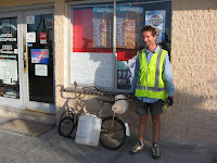 photo.
 photo.
I cycled the 145 km from Nullarbor Roadhouse to the next roadhouse in one day, and it was one of the toughest, hottest days of the whole country's trip. I heard the temperature at Nullarbor got to 47 degrees that day, and no doubt it was far hotter cycling on the road. It was the only day in the whole trip where I had to stop and sit within the shade of a tree for half an hour, not because I needed a water break, but because I was worried that I was going to melt.
The question in these long crossings in heat, head wind, and hills, is how much time to allow to accomplish them. If you plan on getting from one roadhouse to the next in one day, you will want to cut down on water to have to drag up the hills--in which case you'll be obliged to complete the crossing in one day. And if you take more water, you'll probably need it, taking two days because of the extra weight involved. I decided to take less water, which amounted to 12 litres on this stretch. The heat and wind were diabolical, and every time I stopped, the flies would swarm around to make things like preparing a drink quite arduous, and that's even while wearing a face net. I got into the next roadhouse, Nundroo, that evening, and by the time I got to bed in their caravan park, I had drank at least 17 litres of water that day, all of it as sweet drinks for energy.
Finally it was good to reach Penong (pictured just after leaving it); the first place to stock up on food since leaving Norseman, 1100 km before. A day later I fought against the by-now normal fierce head wind to reach the seaside town of Ceduna. That marked the end of the long trek across the Nullarbor, and the entry into South Australia proper with the beginning of the road home.
Finally it was good to reach Penong (pictured just after leaving it);
 the first place to stock up on food since leaving Norseman, 1100 km before. A day later I fought against the by-now normal fierce head wind to reach the seaside town of Ceduna. That marked the end of the long trek across the Nullarbor, and the entry into South Australia proper with the beginning of the road home.
But the long stretches of empty road were by no means finished, and after a couple of days in Ceduna, I headed off down the coast (pictured), heading south east into a south-easterly wind (i.e. it doesn't get much more of a head wind than that) to make for the town of Port Lincoln. I had to proceed slowly here, only cycling in the morning and going down the coast in small bites. I spent a day in the tiny seaside town of Elliston, since the wind was set to switch direction two days later to give me a tail wind.
 heading south east into a south-easterly wind (i.e. it doesn't get much more of a head wind than that) to make for the town of Port Lincoln. I had to proceed slowly here, only cycling in the morning and going down the coast in small bites. I spent a day in the tiny seaside town of Elliston, since the wind was set to switch direction two days later to give me a tail wind.
Elliston has the largest mural in the Southern Hemisphere (pictured), which adorns the sides of their community hall. The bakery is the centre of town when it comes to sitting and watching the people go by; not that there really are any, since they're all mostly sitting at the bakery.


Down the coast from Elliston lies the roadhouse and tiny community of Sheringa. You can see that the area is still quite remote and sparsely populated by the church that sits on its own in the middle of a big field. The wind did switch direction for a half day out of Elliston, and I cruised at speeds that I hadn't seen since before Esperance, 1700 km back--in fact, speeds that I've rarely seen since before Broome, some months ago. In the afternoon the wind switched back to a head wind in the space of a few minutes, and as far as my speed went, it was like cycling into a lake; a good time to stop for the night. A nearby Scout camping centre had been suggested to me as a great place to stop. There was a church group spending a week there, and although it was clear when I arrived that the place isn't exactly open to the public (despite what I'd been told), the people there still made me feel quite welcome, and much chatting was had that evening over hot coffee.
Port Lincoln is a large town and no doubt growing as millionaires buy up land and show off their yachts in its new marina. Still, a good spot for a day off, although I always seem to reach big towns on a weekend when some shops are closed, and so it was here. I think I won't go swimming though: Port Lincoln is where the "real shark" scenes were filmed for the movie Jaws. That aside, one good thing is that there are no flies.
Adelaide lies just 200 km off across the water, but I will have to go around the long way of course, up to Port Augusta, and then trickling down through the small towns of Melrose, Laura, and Clare, finally to enter Adelaide. It's still another 700 km, but I think the bicycle and I can make it.

 The wind did switch direction for a half day out of Elliston, and I cruised at speeds that I hadn't seen since before Esperance, 1700 km back--in fact, speeds that I've rarely seen since before Broome, some months ago. In the afternoon the wind switched back to a head wind in the space of a few minutes, and as far as my speed went, it was like cycling into a lake; a good time to stop for the night. A nearby Scout camping centre had been suggested to me as a great place to stop. There was a church group spending a week there, and although it was clear when I arrived that the place isn't exactly open to the public (despite what I'd been told), the people there still made me feel quite welcome, and much chatting was had that evening over hot coffee.
Port Lincoln is a large town and no doubt growing as millionaires buy up land and show off their yachts in its new marina. Still, a good spot for a day off, although I always seem to reach big towns on a weekend when some shops are closed, and so it was here. I think I won't go swimming though: Port Lincoln is where the "real shark" scenes were filmed for the movie Jaws. That aside, one good thing is that there are no flies.
Adelaide lies just 200 km off across the water, but I will have to go around the long way of course, up to Port Augusta, and then trickling down through the small towns of Melrose, Laura, and Clare, finally to enter Adelaide. It's still another 700 km, but I think the bicycle and I can make it.


Mid January: Port Lincoln to Adelaide, and Journey's End
Total distance at end: 17,065 km.

Through what seemed like heavy traffic, I left Port Lincoln and followed the road over rolling hills up the coast, through the small seaside towns of Tumby Bay, Port Neill, Arno Bay, and Cowell, to arrive at the small city of Whyalla two days later. The south-easterly wind was now a cross wind with sometimes a head wind component, so it was still tough going, and hot too. It became more of a head wind as I covered the last 20 km into Whyalla, by which time it was so strong that I didn't bother putting the tent up when I reached a caravan park. Instead I stayed the night in a caravan while the wind outside raced and bent the trees strongly. It was still blowing by morning.
 I decided to cycle just the 75 km to the big town of Port Augusta that day, and now my direction had changed enough so that for the first half of this I had a tail wind, something I'd almost forgotten existed. Later I needed to change direction slightly to head for Port Augusta, which brought the wind crosswise so strongly that I had trouble keeping the bicycle on the road. This was partly due to the very bare countryside through which I was cycling, which offered no barrier at all to the wind.
I got up the next morning to find a layer of fine dust blown all over my bicycle chain, as if it had been lubricated with a bathroom cleaner like Jif. It's time the shaft-driven bicycle was re-invented and greasy, dusty chains became a thing of the past. Certainly in Australia's dusty regions, bicycles' exposed drive components are something of an anachronism.
An hour down the main highway towards Adelaide after leaving Port Augusta, I turned east to climb through Horrock's Pass into the Flinders Ranges, toward the town of Wilmington, to take quieter and more scenic roads home. The hilly terrain made a welcome change from the flatness I'd grown so used to over the trip, though it certainly was a slow climb along several kilometres through the pass to get to the top (pictured).

An hour down the main highway towards Adelaide after leaving Port Augusta, I turned east to climb through Horrock's Pass into the Flinders Ranges, toward the town of Wilmington, to take quieter and more scenic roads home. The hilly terrain made a welcome change from the flatness I'd grown so used to over the trip, though it certainly was a slow climb along several kilometres through the pass to get to the top (pictured).


And, in a way, it was here that my round-Australia cycle trip really ended, not all at once, but gradually as I cruised down the hill into the familiar town of Wilmington as pictured at left. Although I did get back to Adelaide almost a week later, the road out from Wilmington was part of the familiar southern Flinders, and so it seemed less like I was cycling around the country and more like I was just going on a quick few days' tour of the area.
 Although I did get back to Adelaide almost a week later, the road out from Wilmington was part of the familiar southern Flinders, and so it seemed less like I was cycling around the country and more like I was just going on a quick few days' tour of the area.
Despite these being some of Australia's more picturesque dry-country back roads, in hindsight I realise I took very few photos, probably because that feeling of being on an epic cycle ride had all but vanished. Despite the head wind (of course!), it all felt quite tame and I seldom thought of getting the camera out.
One of those few photo stops shows the "Cheese Tree" (I think it was called) at a roadside rest area with a backdrop very typical of the southern Flinders, just north of the town of Melrose. Apparently the tree was used by an early settler family to make cheese, although the minimal information on the plaque left me none the wiser as to just how that was done.


Even so, roadside stops like these are a part of appreciating the history of the area, and that includes the historic town of Melrose, oldest in the Flinders, dating from around 150 years back (pictured). The photo shows an old blacksmith's shop full of atmosphere that is now a quaint coffee shop, and worth a visit for a cup of tea and a bite to eat.


I took a day off in Melrose to walk the path to the top of neighbouring Mt Remarkable. The path winds for about 6 km along the mountainside (pictured), and en route we get some views of the surrounding country and town. Alas, there is really no view from the top due to heavy tree cover.


The wreckage of a plane that crashed into the mountain in 1980 is still visible on its slopes.

Next day I left Melrose to continue south. (Okay, I'm headed in the wrong direction in the right-hand photo below, but that's what happens when you ride around in circles getting your picture taken...)


The roads south of Melrose lead past fields and along shady roads toward the town of Laura (pictured looking along its main street). Here I spent a sunny afternoon wandering about.


South of Laura the look and feel of the southern Flinders really begins to disappear, and wheat fields (I presume) take over.


The next photos show two monuments that are typically found in small towns all over Australia and New Zealand, honouring locals who fought in the two World Wars. Below we see those of the towns of Auburn (I think) and Tarlee.


But with Adelaide almost in sight, there was still one piece of bicycle maintenance to go. A week before, I'd noticed a small break in the top of the rear carrier's aluminium frame; it didn't look crucial, so I figured everything would last until I reached home. Aluminium is certainly light, but it doesn't have the resilience to constant flexing that something like steel has. What I didn't realise was that the break was allowing the whole carrier to flex, and sure enough, about 60 km north of Adelaide, one of the carrier's two legs broke. Was my bike telling me that it was time to go home? I bound the broken leg carefully with plastic ties to keep it away from the spinning wheel spokes, and cycled very slowly and carefully for a couple of hours into the northern fringe of the town of Gawler. The carrier's other leg was bending noticeably under the weight of the luggage, and if it too had snapped, the bike would have been unrideable. Luckily I was able to find someone here who welded both breakages in five minutes, and I was away again. I stopped in Gawler's caravan park for the night: a last-minute bit of parking to enable some friends from work to organise coming out to accompany me on the last miles home.
Next day they turned up all ready to take the scenic route through the Adelaide Hills. They had accompanied me on the first day out from Adelaide last May through those hills, and remarked on how fast the last eight months had gone by, and how it felt now as if we had all just gone out for a day's cycle just a few weeks before. Somehow the experience of the last eight months seemed quite different to me!
 They had accompanied me on the first day out from Adelaide last May through those hills, and remarked on how fast the last eight months had gone by, and how it felt now as if we had all just gone out for a day's cycle just a few weeks before. Somehow the experience of the last eight months seemed quite different to me!
 After eight months in the sun, my front basket is a whole lot more faded now than it was at the start of the trip; for a comparison with the picture here, see the photo I took of it on the third or fourth day out from Adelaide.
By chance as we left Gawler, the streets were closed as the "Tour Down Under" cycle race came through the town, preceded by lots of police on motorcycles blowing horns amid a festive atmosphere, while the townspeople lined the streets waiting to catch an admiring glimpse of the tight knot of gawdily dressed cyclists who came flashing around the corner and along the main street. I guess I was the only one on that road who didn't deign to look at them: I was wheeling my heavy bike along the footpath, and somehow none of what was happening around me held much significance! We returned to the city through the steep Adelaide Hills. I took a minute of two of movies while flying down these. The next two pictures show some of this, with one of my friends cycling in front. The crazy angles are mostly due to my holding the camera any which way as I cycled .
.
 .
.
We meandered along a bicycle/walking path for the last few kilometres into Adelaide.

A friend took a few seconds' worth of movie of me cycling down my driveway and "crossing the finish line" to bring the bike finally to its last stop on 22nd January, but we neglected to take a still photo of the very end... However, I've extracted three frames from the movie, as shown below. It might seem strange that I didn't get a "proper" photo here, but with hindsight it really did feel like my long bicycle trip had ended gradually a week before, and certainly by the time I reached Wilmington, at the start of the southern Flinders. The cycle through the southern Flinders had such a tame feel that I almost forgot that I really was ending it now, and that was something I had never expected, through all the many times I had visualised finishing the trip as I cycled around the country .
.

 .
.

And how did my tyres fare? The first Schwalbe that I put on the back wheel in Broome is still on the bike, looking worn now but still quite usable. The front wheel's old French-made Michelin lasted right up until one day into the Nullarbor, when I decided to retire it, replacing it with a Schwalbe that is still on the bike. And after that Michelin's monumental performance, I took it home with me to Adelaide. The Schwalbes never got any punctures; my last puncture was actually just before Fitzroy Crossing, way back in the Kimberley. Some people did ask me how much the Schwalbes cost, as opposed to the cheaper tyres that would last only days that I used in the north of the country. Each Schwalbe cost just $40, as compared to the low-quality tyres that still each cost about $20.
The one time a spoke snapped was south of Canberra. As a result of learning how to balance the spokes, I mostly slackened their tension. So perhaps having overly tight spokes is not a good idea on a heavily laden bike.
The chain and rear gear cluster I had replaced in Broome, and the chain again in Esperance, not because they needed changing, but because changing the chain seemed easier than cleaning it; and sometimes you want to change the cluster along with the chain since they need to fit together so well--especially when there's no bike shop for the next 1500 km, so it pays to be safe! Probably if I'd just cleaned the chain it would've been quite happy for the whole trip. [Compare this lasting quality to the story I heard from a cyclist in one of the towns I passed through along the way: he had once cycled from Broken Hill to Adelaide, a distance of perhaps 600 km, on a modern bike that he said had cost about $600. (It had disk brakes, which makes it modern, although I'm not sure what the point is of disk brakes on a bicycle. When used, they must certainly put stress on the spokes.) He said that by the time he arrived in Adelaide the bike was more or less kaput, with broken gear teeth and the whole in a generally unrideable condition.]
My bicycle's bearings, too, performed admirably. For the first one or two thousand kilometres out from Adelaide, the rear of the bike would play some kind of vibrating drum tune every time I put it into the fastest two gears. Neither I nor a bicycle shop I visited along the way could find the reason, and I figured this was due to some sort of resonance that originated in the heavy load on the carrier. I never even noticed when the sound did eventually vanish, or whether that happened before or after I had the rear bearings looked at in Brisbane. (Actually, from my memory of the event, I can't even be certain that the bicycle shop in Brisbane did look at the bearings, despite my asking them to.) I kept an eye on those spinning wheels all through the trip and could only marvel at the way they turned and turned so effortlessly, without ever seeming to complain or tire.
I must thank Peter Giessauf, owner of International Cycles in Adelaide, for preparing the bike before the trip. Peter solved problems in how to attach things to the frame, and generally did a great job at getting it all together, as well as posting the Schwalbes to me en route. International Cycles is not one of those big characterless bicycle shops that just wants to sell you a new bike; rather, if you drop in to visit, you'll most likely see at least one hard-core cyclist in the shop getting advice from Peter, or having something tweaked on his bike.
Photos, photos... I remember back through all the months, of so many people taking photos of what must have struck them as quite outrageous, a lone cyclist in the middle of nowhere, crossing between remote towns in the sweltering heat. People would click at me through their windscreens, or a car would pass with a camera that poked out of a window on two disembodied arms to take a backwards shot; once a car pulled alongside and asked if they could film me on video. The hundreds of photos that I myself took, along with the few minutes of video on my digital camera out of the 870 hours that I spent on the bike, are now just an insignificant fraction of what I experienced, of things that are felt and which can never be caught on film. The bicycle was pushed along by the movement of that marvellous joint, the human knee, each of which I'd say made around 3 million up-down movements, with no ill effects that I can feel at trip's end. And this was just the visible part of the trip. The less visible part was the similar effort required daily to make a home, to put up the tent and take it down, make meals, do laundry, chase flies, mend things, and see to all the other little housekeeping chores that form part of such a long trip.
On trips like these, it's a fine idea to bring along a few small items that mean something to the cyclist. Among my collection were two St Christopher medallions; I carried one, and the bike the other. You can see it hanging below the handlebars in some of the photos.
And, of course, I met so many friendly people along the way. The bicycle serves as an introduction, and many was the time I sat with caravaners and exchanged stories of the road. People stopped to give me water or fruit, and some of them I had even met before, perhaps from 1000 km back. Sometimes when a caravan would stop at a roadside rest area where I happened to be and ask if I needed anything to drink, I would reply, as innocently as I could, eyes gazing heavenward, that I had enough water thanks, but that I could always do with a lemon-lime flavoured cold fizzy drink, just out of interest you understand and not that I'm expecting you to have such a thing. But sure enough, such a drink would be produced from a caravan refrigerator. Great stuff.
And every road along the trip, from start to end, was just as important as every other road. It's natural and human to begin a trip like this by wanting the first few days, the first few hundred--no, first few thousand--kilometres to pass quickly, as if they were not important parts of the trek. Leaving Adelaide seems like an impediment to really "beginning" the trip, and then there is the city of Melbourne to be gotten through, and a cold winter to be tackled before heading up the east coast to the Tropic of Capricorn and into warmer weather. Then the long westward leg, beginning literally in the space of a hundred yards after leaving the small town of Mt Garnet a little west of Cairns. A detour south to Cloncurry, and a "side trip" north to Darwin, before tackling the lonely Kimberley, and finally being rewarded for all that effort by a head wind beginning around Broome, down the coast, shielded by trees in the southern karri forest, then across the hot Nullarbor Plain, with that wind never really quite ending until Adelaide. Always, always, I was hunting for the next leg of the trip, and suddenly, before I was quite ready for it, the trip was done. All those nights when I slept little and then had to get up early to begin an arduous ride that would take me 100 or 150 km from nowhere to nowhere. Then suddenly, surprisingly, Adelaide appeared on the horizon and I was wondering whether I had really cycled around the country after all.
Still, as with any effort that takes so long, there'll be much to think about as I mentally digest the trip in time to come. For now, I have the satisfaction of knowing that I made it; I "did the loop"--and got home at last, with memories enough to last a lifetime. So many memories, in fact, that not even a road train could hold them all.
(The following cryptic-looking line is added automatically by the software that makes this page.)